Crtd 07-09-24 Lastedit 18-01-21
To Ukerewe
Brothers and Sisters
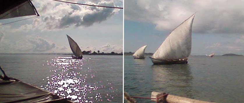
070924 05:30 S 0-2, but N again, we can only lift anchor at 07:00 on SW 0-1, to weak for gybing (lateen gybing explained), but we succeed 07:40 on a little puff and head East.

Photo: Brothers and sisters!
Now we are in the Victoria Lake South cost dhow trade route.
Dhows all over. In passing, they shout jokes: "what are you doing here with
this Mzungu dhow, I see too many stays!". Those who are less inventive can always fall
back on the basic greeting, that is, to raise your arm cordially and shout "I go
fuck your mother!". We are the fastest but sailing sharp have much more drift,
both because we are unloaded. At 08:00 a wind shed imposes itself between Kahundu and us. West of it wind stays Westish and weak. We get a NE 3-4. One
cargo dhow 400 m behind us stays in the lull of the wind shed and we even
loose sight of it. We remain with two others on the good side of the wind shed.
The two others can keep more height and manage to pass Ukurukuse Point, rocky
outermost Southern mainland point of the waters leading to Mwanza gulf (Mwanza
87 km ESE). At 15:42 we arrive 4 km South of Ukurukuse Point. We will not be able
to round in today's afternoon wind. We moor. Discussions now concentrate on our Mwanza approach. All
our papers are OK, but Mwanza immigration might start monkeying again, eager to
dabble another "order to leave" in my passport (surfboard about
Mwanza Immigration). Of course I want a new camera,
to be bought in Mwanza, before we do the family visits to Doi's and Philemon's
places. Also we want to order a decent Tanzanian canoe in Mwanza - our Uganda
make is thoroughly finished - but building a canoe takes two weeks. My idea is to
stay to our plan, go to Ukerewe first. I will take the ferry (3 hrs.) to Mwanza,
Philemon could join me to talk to the canoe builder and pay an advance.
Philemon deems Ukerewe main town Nansio not suitable for mooring during our
Mwanza ferry trip: the dhow is too spectacular. There will be too many people
asking each other who knows about it, we will surely see police, customs, and
may be lake security, they might involve immigration, who might contact Mwanza.
Better to go to a beach near Doi's village Kagunguli, passing 8 km S of Nansio,
then through a remarkably narrow channel between Ukerewe and the mainland, then
North another 14 km). Kagunguli is blessed with daily ferry connecting
busses, so I can visit Mwanza from there.
After Kagunguli we shall visit Magita, the mainland area of Philemon's family's
village Kasoma (others say Ruanga). After that, our canoe should be
ready in Mwanza, and mooring 10 km North at the beach of the house of Ton
Bronkhorst, a Dutch friend, who already called yesterday to say he looked
forward to it. We will eat, he announced, notoriously Dutch food like green pea
soup and cauliflower. From there we might do our Mwanza agenda
retrieving finished canoe
buying new anchor lines
repairing one anchor
making new folmali
buying spare cotton for sail
In sum: we plan to pump a lot of hard currency in the Mwanza economy, but to succeed in that Mwanza Immigration should spot us late, or, preferably not at all.
070925 07:00
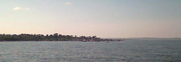
Passing Ukurukuse, rocky outermost Southern mainland point of the waters leading to Mwanza gulf (Mwanza 87 km ESE)
09:00 We anchor 3 km NW of Ukurukuse, rocky outermost Southern mainland point
of the waters leading to Mwanza gulf (Mwanza 87 km ESE) with NE 33o
Bf3, waiting for the afternoon backing, which Philemon says can be much earlier
here.
13:00 Wind backs to NE 22o. Dhows start to try going E
along the shore line. We set sail too. Due to our drift we will need a few
degrees back more within the next few hours. Wet get it.
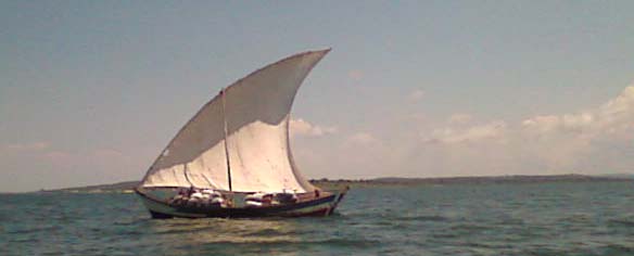
Photo: Charcoal to Mwanza
18:00 We reach Mshangani, last hide before 60 km open lake cross to Ukerewe
070926 07:00 Sunrise, NE. Headwind. No chance to get any nearer to target.

Photo: engine boats preparing to bring their cargo to Mwanza (the little suspended hut is for sleeping)
Engine boats next to us prepare. No wind problems. Time
schedules. Progress is unstoppable ("neither is degeneration", I am used to add
in special types of company). I read
Faust. Mephisto has
already helped him to fuck Gretchen (15 years at most). Religious Gretchen in distress
concerning her sin, Faust, in love, remorse and longing but not yet completely
down, now climbing, with Mephisto, a Harz mountain full of devils ("Walpurgisnacht").
I suddenly realize that Mephisto, by initially appearing as a dog to Faust, must
have inspired my wording in the
"church leader's" discussion at Kahunda.
Meanwhile every other canoe passing us slows down and tries to approach us in
the intrusive way characteristic of the negro: pretending to help or welcome,
overdoing their friendliness they are already climbing on your dhow before even
asking you. Nothing helps but assuming the harsh attitude they know and fear
from their government officials and blast them off.
13:30 Wind turns N, we set sail
Photo (mobile phone through binoculars) Island forest ship yard
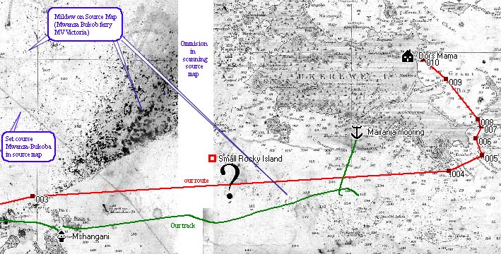
Map: our computer GPS navigation struggling with mildew and a scanning error (003-004: 75 km)
We navigate on ferry MV Victoria's old and damaged copy of the best map of
the lake, an English admiralty map 1902-06 updated until 1955. The map is 100 by 75
cm and I scanned it in the navigation hut of MS Victoria with my portable A4
scanner and laptop in 24 portions. jpg files of these 24
portions I put together again in the computer ("rotate 0.12o
clockwise", "skew", "perspective" etc.) and calibrated (to have
computer overlay of GPS positions) under Fugawi Navigator software. So I can set
a route (red) in GPS coordinates, and the GPS records my track. Those are
precise up to 12m. The question is whether by calibrated I put the map "under"
the red and green lines in the proper position or, instead of Ukerewe, suddenly
sight New York's statue of liberty.
My resulting
maximum error (derived from samples of points known exactly from professionally
calibrated maps) is 1.5 km. For instance, our mooring Mchangani is indeed where
our GPS track (the green sequence of GPS positions) actually told us we were,
error less than 1 km. But now we enter a tricky zone: a) there was mildew damage
on the source map b) we will pass a zone that I erroneously omitted in scanning.
The map really looks scary. Fortunately, we know from other maps that the right
side of the white zone, Ukerewe, is
positioned with no less accuracy than the left side. Moreover,
we cross deep lake with no rocks or islands. But the proof of the pudding is
whether at point 004 we are indeed where the map says we will be: 300 m SE of
rocks between Bukimbwi bay and Missuri Point, Ukerewe. And for the rest:
Philemon knows every single rock in this area, so we might as well switch the
laptop off.
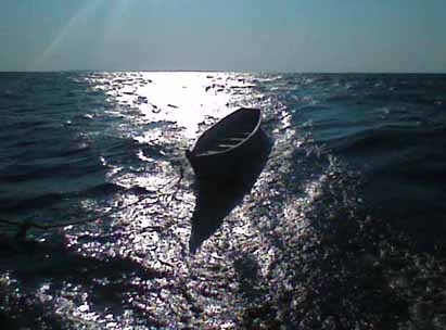
Photo: Our canoe with N Bf 6 in the "white zone"
With N 6 we enter the white zone in the middle of which we
have to bear down a bit for fear of overstraining our folmali, but 40 min later
we can broach to course until 21:30 when wind veers NE. We anchor in 40 m depth,
waves ease after evening wind drop.