Crtd 14-07-05 Lastedit 20-12-04

The course of the Rhine delta branches is what made, in the 16th century, Amsterdam attractive as a merchant storage and trade centre. Reaching the sea with your merchant ships was easier elsewhere: Groningen, the Frisian towns, Antwerp. But those towns were exposed to the land side, where the Big Robbers would like to come from: the Kings, Princes, Bishops and other rulers of the European feudal class. They assaulted from horsebacks, not from ships, and for their aggressive earthly ambitions the Amsterdam Rhine delta foreland was depressing, all the more since the Dutch used their expertise in water level control to define a defence line to be inundated at danger and form an impermeable swamp, the "Hollandse Waterlinie" (Dutch water line).
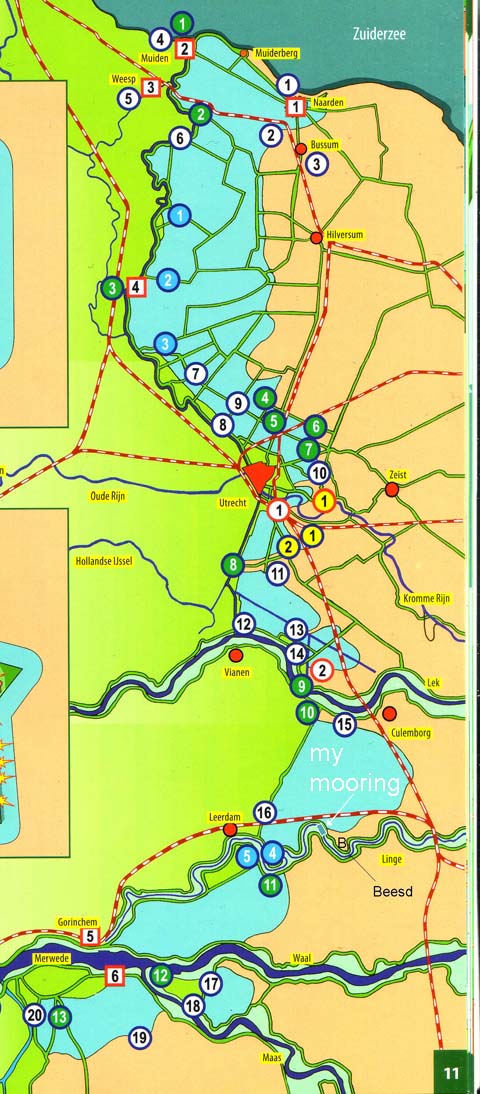
 The blue on the map (left)
is only very partly lake in peace time, but can be turned into shallow,
unnavigable swamp by redirecting water of the rivers and Zuiderzee
(nowadays an inland lake). Louis XIV tried to cross it in 1672 with stunning superior forces.
The water came in nervewreckingly slow due to drought but in the end he had to retreat.
While the Dutch army was helplessly inferior! The French in their revolution times attack had the luck of a population alienated by the exploitation of the Orangist elite, helping them over and teaching them the mudtricks, but above all those French had the incredible luck of heavy frost. In the meteorologically unique winter weeks early 1795 even the salt sea to the Northern Islands could be crossed by pretty heavy armies. Dutch warships, still Orangist or pretending to be, were frozen to the solid sea ice and reduced to wooden land forts easily taken.
At the preliminaries of the First World War, German intelligence
reported headquarters that the Dutch Waterline "invincible".
The defense value of the delta ended with the advent of airplane bombers and parachutes. In their 1945
defense,
the Dutch military shunned reliance on the Water Line and engaged in useless resistance at the high end of the Eem,
30 km East of the Water Line (see map top of page). The Germans simply threatened to bomb Rotterdam to destruction. That threat should have been enough,
where it not that the Dutch leaders waited for a proof of the wisdom of
surrender tangible to a
wider audience, in an attempt
to save what was left of their reputation. Rotterdam city went in ruins
almost completely.
The mooring site of my platform is spot on the east virtual
shore of the Dutch waterline. It is marked white on the map left, but the
blue North and West is now all dry land covered with fruit trees and will
remain so until the end of local civilisation.
In Roman
times a nice
wet and muddy river delta, some ships and spades, was a safe place to be, even limiting yourself to
my river "island" between Nederrijn and Waal. At that time, it still kept the robbers at
a distance, provided you were a competent robber yourself, like the
Batavian
Gaius Julius Civilis protagonist of Tacitus Historiae, all of which is not to say you are clear
of
environment hazards
.